
What is a physical map?
A physical map emphasizes natural features such as mountains, plains, plateaus, rivers, lakes and coastlines. Unlike a political map, its primary structure comes from terrain and water rather than administrative boundaries.
Physical geography · interactive
Raise the terrain, trace the major rivers and quiet the political colors. This physical map is built to make landforms readable rather than decorative.
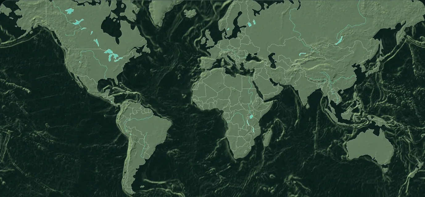
A physical map emphasizes natural features such as mountains, plains, plateaus, rivers, lakes and coastlines. Unlike a political map, its primary structure comes from terrain and water rather than administrative boundaries.
Shaded relief uses light and shadow to suggest the shape of the land. The 3D control adds perspective, but it is still a generalized visualization. Use it to understand broad patterns—such as mountain chains and basins—not to read an exact elevation at a point.
Physical features frequently influence settlement, transport and political history. Rivers concentrate movement and agriculture; mountains can slow it; coastlines connect regions. The optional border layer helps compare those physical patterns with modern states.
Landform reading guide
| Feature | What it is | How this map suggests it |
|---|---|---|
| Mountain range | A connected area of high relief | Concentrated light and shadow in the relief layer |
| Plain | A broad area with relatively low relief | Quieter, more even terrain shading |
| Plateau | Elevated land with a comparatively level surface | Raised terrain with gentler internal relief |
| Basin | Lower land surrounded by higher terrain | Shading that falls inward from surrounding relief |
| River system | A connected drainage network | Cyan lines flowing toward lakes or coasts |
Questions, answered
It can. Borders are secondary in physical mode and can be switched off so terrain and water remain dominant.
Elevation is height above a reference level. Relief describes variation between higher and lower terrain. Shaded relief visually suggests that variation.
No. The terrain layer is for global visual context and is vertically exaggerated in 3D mode. It should not be used for engineering, safety or navigation.
Keep exploring